
Widgets
Every widget renders into a floating panel at an edge of the globe (position: top-left, top-right, bottom-left, bottom-right, top-center, bottom-center) and needs the shared stylesheet. React names are shown; the Angular selectors are ww-layer-switcher, ww-navigation-controls, ww-goto-box, ww-coordinates, ww-measure-tool, ww-projection-switcher, ww-scale-bar, ww-compass, ww-attribution, ww-legend, ww-time-slider and ww-draw-tool, with the same inputs.



LayerSwitcher
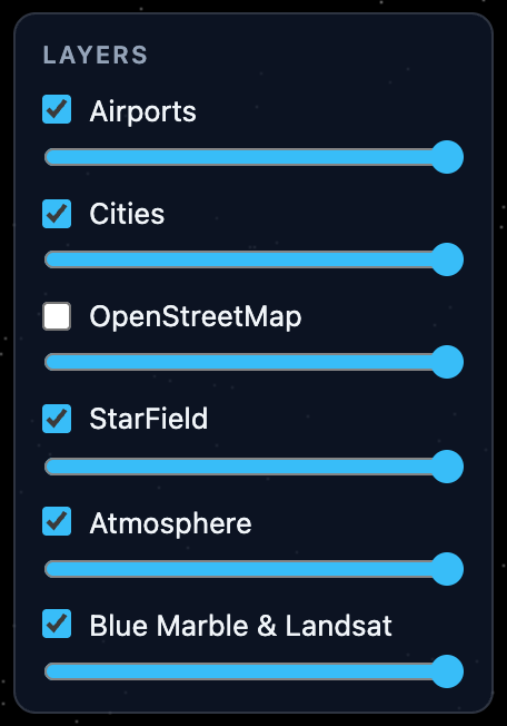
A checkbox and an opacity slider per layer, top-most layer first. Screen-space layers (compass, coordinates, view controls) and tool-owned layers are hidden by default.
| Prop | Default | Purpose |
|---|---|---|
heading | 'Layers' | Panel heading; null hides it |
showOpacity | true | Opacity slider per layer |
hideOverlays | true | Hide screen-space and tool-owned layers |
topFirst | true | List order |
filter | (layer) => boolean |
NavigationControls
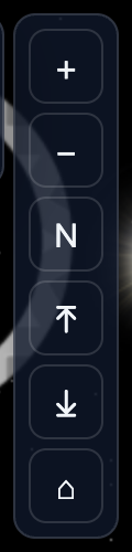
Zoom in and out, reset to north, tilt up and down, and a home button.
| Prop | Default | Purpose |
|---|---|---|
zoomFactor | 2 | Range multiplier per step |
tiltStep | 15 | Degrees per tilt step |
showTilt | true | Tilt buttons |
home | whole globe | CameraTarget, or false to hide |
animate | 1500 | Home flight in ms |
orientation | 'vertical' | Or 'horizontal' |
fullscreen | false | Adds a fullscreen toggle for the globe and its widgets |
screenshot | false | Adds a button that saves the globe as an image; an object sets type, quality and filename |
The kit offers the same as toggleFullscreen(globe), captureScreenshot(globe) and downloadScreenshot(globe, options). Screenshots are taken inside WorldWind's redraw callback, so they work without preserveDrawingBuffer.
GoToBox
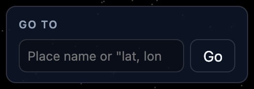
Type lat, lon (40.7, -74, 40.7N 74W) or a place name. Coordinates fly immediately; names are geocoded with a Nominatim-compatible service and multiple matches are listed.
| Prop | Default | Purpose |
|---|---|---|
duration | 2000 | Flight in ms |
defaultRange | 200 000 | Metres, when a result has no bounding box |
geocoding | public Nominatim | GeocodeOptions (endpoint, limit, language, fetch), or false for coordinates only |
onNavigate | (target, result?) => void |
The public OpenStreetMap Nominatim is for light use only; point endpoint at your own for anything heavier.
CoordinatesReadout
Latitude, longitude and terrain altitude under the mouse, plus the camera range. Turns hover picking on while mounted.
| Prop | Default | Purpose |
|---|---|---|
format | 'decimal' | Or 'dms' |
precision | 4 / 1 | Decimals, or seconds precision for dms |
showAltitude, showRange | true | Fields |
MeasureTool
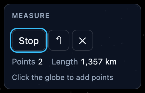
Press Measure, click the globe to add points: the line and vertex markers live in the tool's own layer, the readout shows the path length and, from three points, the polygon area. Undo and Clear do what they say.
| Prop | Default | Purpose |
|---|---|---|
pathType | 'greatCircle' | Or 'rhumbLine', 'linear' |
followTerrain | true | Measure along the terrain |
line | cyan, 2 px | ShapeStyle for the line |
The hook useMeasureTool() (React) or the MeasureTool class (kit) gives you the same state without the panel.
Popup
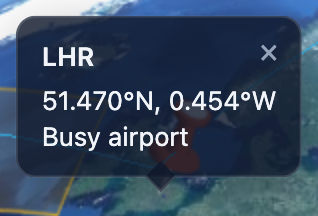
Not a panel but an overlay anchored to a geographic position: it follows the globe every frame and hides while the point is behind the globe or off screen. Content is ordinary markup; title (React) or heading (Angular) adds a bold first line and onClose / closable a close button. The demos open one when you click a city pin or an airport.
| Prop | Default | Purpose |
|---|---|---|
position | { latitude, longitude, altitude? } | |
anchor | 'bottom' | Side of the point the popup sits on (bottom means above the point) |
offset | { x, y } in pixels | |
hideWhenHidden | true | Hide when behind the globe or outside the viewport |
The kit exposes the same machinery as globe.toScreen(position) and globe.trackPosition(position, listener).
ProjectionSwitcher
Buttons for the 3D globe and the flat projections (equirectangular, Mercator, north and south polar). projections limits the choice, labels renames buttons.
ScaleBar
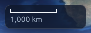
A bar showing a round ground distance (1, 2 or 5 times a power of ten) at the current zoom. The resolution comes from WorldWind's own pixel size at the look-at point, so tilt, projection and device pixel ratio are all accounted for.
| Prop | Default | Purpose |
|---|---|---|
maxWidth | 120 | Longest bar in pixels |
units | 'metric' | Or 'imperial' (ft, mi), 'nautical' (m, nmi) |
The kit exposes the same numbers as globe.trackScale(listener, options), scaleBar(wwd) and computeScaleBar(metersPerPixel, options); React also has useScaleBar().
Compass
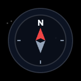
A rose that turns with the camera heading. Clicking it resets the heading to north (resetOnClick, default true); onClick (React) or (compassClick) (Angular) receives the heading that was showing. size sets the diameter in pixels (56).
Attribution
A slim strip crediting the data behind the visible layers. Credits come from three places: defaults for WorldWind's built-in layers (NASA imagery, OpenStreetMap, Bing Maps), the <Attribution> element of a WMS capabilities document, and the attribution option any layer can set ('Data: ACME' or { text, url }; null suppresses a default). Renders nothing when there is nothing to credit.
| Prop | Default | Purpose |
|---|---|---|
position | 'bottom-center' | Any panel position |
extra | Credits shown after the layers' own | |
includeDisabled | false | Credit layers that are switched off too |
separator | ' · ' | Text between credits |
Kit: layerAttribution(layer), collectAttributions(layers), setLayerAttribution(layer, credit) and DEFAULT_ATTRIBUTIONS; React: useAttributions().
Legend
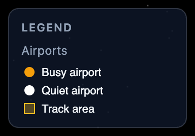
Legend images of the visible layers, top-most first. Layers built from capabilities carry the LegendURL of their WMS style or WMTS style; any other layer can set legend to an image URL or { url, width, height }. Renders nothing when no visible layer has one.
| Prop | Default | Purpose |
|---|---|---|
heading | 'Legend' | Panel heading; null hides it |
showNames | true | Layer name above each image |
includeDisabled | false | Include layers that are switched off |
Kit: layerLegend(layer), collectLegends(layers), setLayerLegend(layer, legend) and wmsLegendGraphicUrl(options) for servers that answer GetLegendGraphic; React: useLegends().
TimeSlider
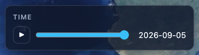
A slider with play and pause that steps time-enabled WMS and WMTS layers through their time dimension. Layers built from capabilities know their dimension (Dimension / Extent with name="time", or a WMTS Time dimension); other layers take one through the timeDimension option, and the slider itself accepts start, end, step and values when the layers declare nothing. By default it drives every layer with a dimension; layers narrows that.
| Prop | Default | Purpose |
|---|---|---|
start, end | from the layers | Date or ISO string |
step | finest declared step, else one day | Milliseconds |
values | Explicit instants instead of a range | |
value, defaultValue | the layers' default, else end | Controlled or initial instant |
onChange / (valueChange) | Called with the instant | |
timeFormat | 'auto' | How TIME is written: 'date', 'datetime', or a function |
playInterval | 1000 | Milliseconds between steps |
loop | true | Start over at the end |
showPlay | true | Play and pause button |
WorldWind only reads TIME when a layer is constructed, so the kit's setLayerTime(layer, date) (also globe.layers.setTime) updates the layer's URL builder and expires its imagery: the old tiles stay on screen until the new ones arrive. The demos drive NASA GIBS daily MODIS imagery this way:
<WmsLayer
  service="https://gibs.earthdata.nasa.gov/wms/epsg4326/best/wms.cgi"
  layerNames="MODIS_Terra_CorrectedReflectance_TrueColor"
  format="image/jpeg"
  timeDimension={{ start: new Date('2024-01-01'), end: new Date('2024-01-31'), stepMs: DAY_MS }}
/>
<TimeSlider position="top-center" />
The kit's parseTimeDimension('2024-01-01/2024-01-31/P1D'), timeDimensionFromCapabilities(layerCapabilities) and resolveTimeDimension(layers, overrides) give you the same data without the widget.
DrawTool
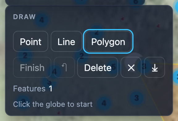
Draws points, lines and polygons and edits them afterwards. Pick a shape, click the globe to add vertices, and finish a line or polygon with a double-click, Enter or the Finish button. Click a finished drawing to select it: its vertices get handles you can drag, Delete removes the selected vertex (or the feature once it is at its minimum), Escape deselects. Everything lives in the tool's own layer and round-trips through GeoJSON.
| Prop | Default | Purpose |
|---|---|---|
onChange / (featuresChange) | Called with the features whenever they change | |
showDownload | false | Button that downloads the drawings as GeoJSON |
editable | true | Allow selecting, dragging and deleting |
finishOnDoubleClick | true | |
keyboard | true | Enter, Escape, Delete and Backspace on the focused canvas |
line, polygon, selected | orange | ShapeStyle for lines, polygons, and the selection highlight |
pointImage, pointScale | red pushpin | Point features |
handleImage, handleScale | white dot | Vertex handles |
Dragging works because WorldWind's navigator ignores a press whose default was prevented: the tool claims the press when it lands on a handle or a point, and the globe stays put. The hook useDrawTool() (React) and the DrawTool class (kit) expose start, finish, select, removeSelected, toGeoJson and load without the panel.